Monday, August 6, 2012

Sonoro Pass...Route 108

Columns of the Giants
water fall
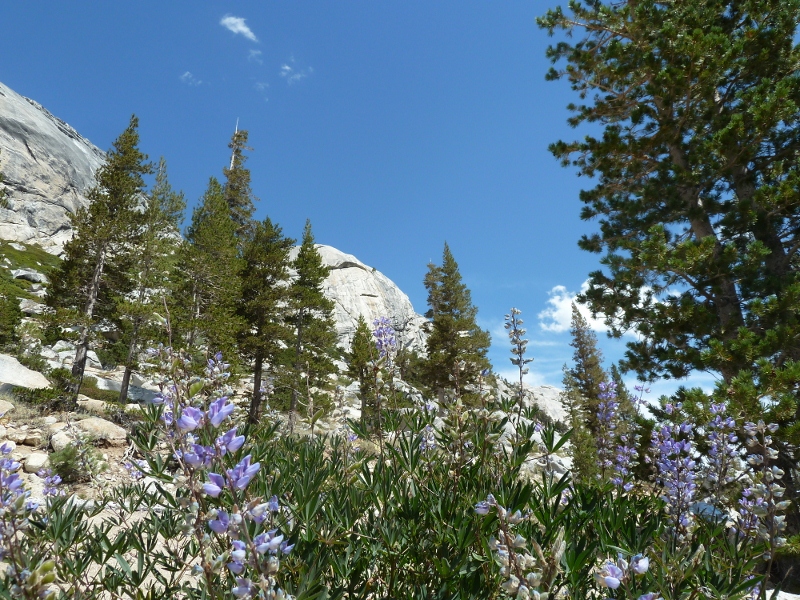
What can you say about a road that wasn't all that long distance wise, but the time it took to drive was a bit over 9 hours.  Mainly due to the views...incredible.  A awful lot of 'distractions'...lava columns, rocks to climb, waterfalls, wide open vistas, the most fantastic trees growing straight out of granite rock.

We'll let the pictures speak for themselves.

More lava


Dardanelles
View from rock hillside
Dardanelle Reservoir
Need more rocks
How? Growing in solid granite


BIG tree

Rock climbing

Sonoma Pass area


Sunday, August 5, 2012

Yosemite in Three Days

First view of Yosemite Valley
We stopped by the Ranger Station Thursday in Stanislaus National Forest to see what info we could get about the National Forest campgrounds close to Yosemite.  It seemed the way to go since most of Yosemite's campgrounds are reserved...a few are listed as walk up, but we chickened out.  Did not want to get to the Park and have no place to camp.  It turned out to be an excellent decision.  Sweetwater was a very small 14 site campground set among some large trees.  As the Ranger suggested it was the best- nice and quiet...with some insect noise which we missed while in Oregon.

Cooper's view of Half Dome

Coop's new friend
Heading out to Yosemite we were amazed by the number of cars, RV's and trailers heading to the Park.  We now know why it's the 'most visited'...also the most crowed Park we've ever visited.  One thing we noticed was the hurried pace quite a few visitors seem to be in which led to less interaction between everyone.  Everywhere else has been pretty friendly...especially with Cooper in tow.  Most people have acknowledged the dog...not in Yosemite.  We figured it was due to the large crowds...you can't say hello to everyone.

Our first day in the park we decided to wander down into Yosemite Valley...exactly were the crowds happened to be.  The roads were pretty packed, but the picnic area at El Capitan was surprisingly empty.  We picnicked across from its massive face.  Cooper only cared about his yogurt cups and was less impressed by the views. 

Bridalveil Fall
After lunch we checked out Bridalveil Fall.  It was one of the most mesmerizing falls we've seen.  The wind seemed to hold the water back and then release it.  It fell down the cliff, blew sideways, back up the cliff and all around the cliff face.  It was awesome.  We went back early the next morning, but the effect wasn't the same...little to no wind.

We drove a bit to see what the Valley Campgrounds looked like...wow.  Glad we chose Sweetwater.  The sites were very tightly packed...first thought was 'sardines'.  Not a pleasant thought of spending a night so close to other campers.  It was not possible to have quiet with that many people crammed into one area.  Not to mention the setting...yeah you're in Yosemite Valley, but how could you enjoy the ambiance since these areas seemed to lack the natural element of camping.

After dinner we  headed back to Groveland, the closest town, for gas and a few supplies...namely yogurt I seem to have become a addict.  As luck would have it right next door to the Iron Door Saloon (claims to be the oldest saloon in CA) was a small ice cream store that actually had huckleberry ice cream, yum!


View of Half Dome from Glacier Point


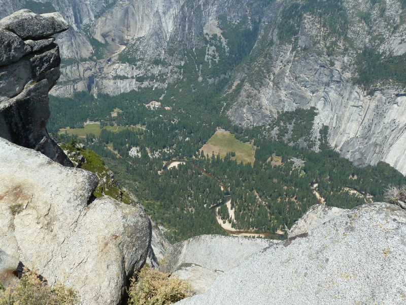
Valley floor from Glacier Pt.
On Friday we headed off to drive the road to Glacier Point in the Park.  Another spectacular road with stunning views of the valleys, waterfalls and mountains.  Yosemite's landscape with granite mountains and deep valleys was really unique and we can see why it is the busiest national park.  Still, you had to mentally block out the crowds to really enjoy the vistas.

After dinner, more huckleberry ice cream. Yum, again.

Can you see the people?  Line going up left-hand side*

On Saturday we thought we would try to avoid the crowd by taking Route 120 through the park over to the east side.  If that was uncrowded, I can only imagine what the main park looked like. Yikes.  Still it was another great drive and the views were a bit closer than those in the main Park.  Of particular note, at one of the overlooks you could see hikers on Half Dome trail.  You have to ascend the granite rock using cables and from the view point we could see why, wow.   All of that after 7 miles of hiking out to it...then turn and hike 7 miles back to the Valley.  It's an impressive hike- 14 mile round trip, a increase of 5000 feet, and at least 12 hour hike.  Since 2008 the foot traffic (1200 hikers) had increased so dramatically for the Half Dome hike the Park Service instituted a lottery system until they come up with a 'better solution'.  Now you have to apply to hike the Dome 3 days prior...350 are chosen daily.   Still seems like a huge number to be traversing such a face.  No way could we undertake that hike.   After our Mt. Thielsen adventure we know our limits.

Climbers
On several miles of road were granite cliffs that the rock climbers had taken over.  Wow, again.  Watching these climbers made Cindi dizzy...me too.  After dinner, more huckleberry ice cream except this time they were out.  Darn, had to settle for coffee and strawberry.

Sunday it was off to Carson City and a much needed shower.  We choose to take Route 108 across the mountains...a great choice.  It took us 9 hours to make the 180 mile trek.  Went up to 9,000 feet at the Sonora Pass.  First time I've ever seen a '26% Grade' sign.  Thankfully 2nd and 1st gears worked flawlessly on the CRV.  More curves and spectacular views of mountains, waterfalls and snow fields.  Perfect blue-sky day to boot.  Cooper was super thrilled to see Nevada and leave California behind...can't you tell?

Super thrilled

Extra note: it is possible to wash an 80 lb lab in a 2.5' square shower; not easy, but possible.  We all smell better.


*click pictures to enlarge...really you've got to click Half Dome to see the line of crazy people


Tuesday, July 31, 2012

The Turn Towards Home

Coastal road views
Today we headed south on CA-1 along the coast towards San Fransisco.  Since we were fairly close it was decided we'd drive over the Golden Gate Bridge...even if it was out of the way and we worried about traffic problems.  What the heck we threw caution to the wind...after all "the journey is the destination." 

More coastal road
 Another view
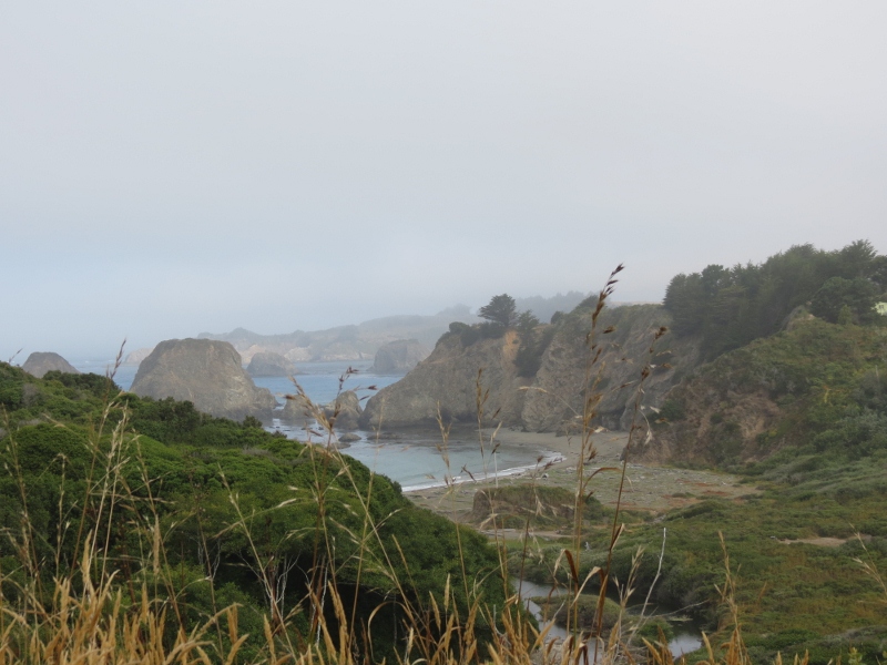
The road south did not take us nearly as long as we thought it would and we hit San Fran about noon...surprising for us to be early.  We had figured that stops along the way would create a problem getting into the Bay area later than we wanted.  The weather though conspired against us and created lots of fog along the coast so there wasn't too much to stop and look at along the way.  These were a few of the best shots of the day...a wee bit of sun and clearing make all the difference.


Yet one more
Nap time


Cooper was less than thrilled about the whole experience.  He missed his morning nap due to frequent stops and the curvy road.  He'd much rather have a smooth ride so he can nap the morning away.  Coop caught up with his nap after we got out of the city and started motoring at 65 MPH. 


Happy sailing


We stopped at the earthen works on the north side for our first look at the bridge.  Let's rephrase that...tried to get a look at the bridge.  We walked up the hill to the overlook with the wind whipping.  About the only ones thrilled with the weather were the sailboats out in the Bay.  They were really moving. 


Fog over the bay

Golden Gate- north side
We knew it was going to be socked in by fog...heavy fog shrouded the Golden Gate.  Surprised?  Nope, we had already figured that the fog would be the enemy.  Oh well on the flip side the traffic wasn't too bad...no jams, no stops.  Things moved so quickly that we arrived in Oakdale, CA early enough to enjoy a cone of handmade strawberry & coffee ice cream at The Big Dipper shop.  Cooper got his treat...the tip end of our waffle cones.


Fog...darn it
Traffic moving- south


Tomorrow we'll be in Yosemite National Park...not sure we'll be able to post while camping.  We'll see how it goes since we'll probably end up in one of the National Forest campgrounds.  Who knows maybe we'll be as lucky as we were at Diamond Lake.

Monday, July 30, 2012

Out of Oregon

Oregon coast
We left southwest Oregon behind on Monday and headed toward the Pacific Coast Highway.  We decided to head to Yosemite National Park.  Sure it's the long way, but we've got to drive the Pacific Coast Highway at least one time.  Of course the route we took from Diamond Lake to Gold Beach, OR was a wee bit shall we say curvy.  At only 186 miles you would think it would not take almost 5 hours...it did.  What a road.  Narrow in spots, no guard rails and our high speed actually hit 25 MPH!  Thankfully no lumber trucks were out and about while we drove.

Once we arrived in Gold Beach we wandered around looking for a dinner spot with outside seating...none existed.  We ended up at a family restaurant that served up homemade pies...Cindi's dessert was egg custard and mine was a local amber ale whose name escapes me.  No outdoor seating meant that poor Cooper waited in the car.  The cool temperatures were good for allowing us to eat indoors while he was in the car napping.  He did get a few french fries and a piece of toast so he was a happy dog when we returned bearing gifts.

Redwoods
The next morning we headed down the coast in search of redwoods and beautiful ocean views...we found cool morning fog.  This blocked our view of the ocean for miles...glimpses were seen that made us wish for sunny blue skies.   Once we hit the redwoods we wandered around a bit following one road and then another until we stumbled upon a herd of elk.  One could say rather tame elk despite all the signs warning people that these were "wild elk".  Cindi amused herself picking fresh blackberries along the roadside and keeping Coop company.

Damn velvet...need more grass

You looking at me?
We headed out to the beach to check out Fern Canyon and to see if elk actually were on the beach at this particular campground.  The road to this spot was another narrow, bumpy, twisty road...with creek crossings to add even more dirt to the car.  Thankfully no trees were damaged while getting out of the way of oncoming vehicles.

Fern Canyon
Since the dog could not hike to Fern Canyon Cindi wandered off to see the ferns while the guys napped.  She said that the ferns covered the entire sides of the canyon walls.  At the time she did not realize that all of it had originally been created by gold mining back during the gold rush...now totally naturalized by ferns and moss.  She also found the elk in the salt marshes close to the parking lot...off to get pictures I almost had a very close encounter with a large male elk.  He looks a bit put off, but kept on eating. 

Oops...surprised me!
What?
We headed out of the Park and found another one of those roads that our GPS claimed 55 MPH and less than 60 miles to our hotel in Fort Bragg.  The miles were correct, but the speed was 20 MPH at best.  The route was CA-1 which wandered through the redwoods and up a few hillsides on its way to the coast.  There was a good bit of laughing going on as half of us saw the turn coming up while the better half gripped the steering wheel.  Coop did his part by wanting to sniff the outdoors since we were only traveling at 20 MPH...until he needed to get out and recover his senses while Mom was driving. 


Curves at 55? Hell NO!
Once we hit town we again looked around to find outdoor seating...none existed.  We wonder what's wrong with these people...weather is nice and no one's outdoors.  McD's was Cooper's choice since it was really well past his dinner and he wanted something quick. 

Tomorrow we head over the Golden Gate Bridge on our way to Yosemite Valley...should be an interesting drive.  Neither one of us enjoys driving in traffic...especially in large cities where people drive so erratically.


Roosevelt Elk in marsh

California coast

Sunday, July 29, 2012

Even More Water Falls

Our last view of Mt Thielsen
It looks like we may never leave Diamond Lake, OR...the weather is terrific, the hikes are amazing and we have hot showers.  The only thing missing is?...well nothing really.   The knees are feeling better so we decided to take in a few more water falls in the Diamond Lake area.  Remember our "Thundering Waters Brochure"? 

Clearwater Falls
A few miles away was Clearwater Falls.  It was certainly close to the parking lot so there was no need to worry about the hike.  All we needed to do was pull out the cameras and decide how many shots we needed.  The falls had many different components that made it interesting to shoot.   Lots of smaller ripples dropping down the 30 foot slope created a lot of opportunities to blur out the water.

Whitehorse Falls
We jumped back in the car for the short ride to the second fall of the day, Whitehorse Falls.  It was also right in the middle of a campground.  A somewhat smaller waterfall there really wasn't much to it.  Pretty, but we've seen much nicer ones.  Off we headed for the third and last waterfall....Watson Falls.

Watson Falls
This one was almost 1/2 mile hike up the mountain slope moving along a small stream.  The Falls could be seen from a small foot bridge crossing the stream.  Easily the most impressive one of the day.  It fell over 270 feet down the lava cliff side...the tallest one in southwest Oregon.  The trail took us up the hillside about midway to the top.  It was a bit chilly as the spray fell around us.  Cooper didn't mind that he couldn't swim in the pool below...not much pool to swim in anyway.

Blur of Watson Falls
No pool for Cooper

More drama

We thoroughly enjoyed our time in the Diamond Lake Recreation Area...it's going to be hard to top.  Maybe we'll get lucky on our next campground in the National Forest, but we're not counting on it.  We'll be happy if there's running water!

Final sunset at Diamond Lake


Off to the coastal road heading down to the Golden Gate Bridge...if we can stand the traffic.