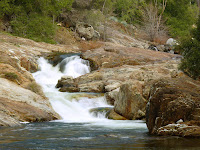
I'll be brief. The giant sequoia trees are, in fact, giant and you could, in fact, die in Death Valley. As a side note it would be a really pretty place to die.
Basically, the pictures don't do justice for either, but words will do even worse so I'm not even going to try.
I hope y'all enjoy the pics.
These trees are REALLY big.


As we drove along one of the side roads we found a grove of some sort of fruit trees outside Fresno...a lot of trees in shades of lovely pink & white.

A red-tailed hawk gave us a pose on an old chimney on our way out to Sequoia National Park. As you can probably tell he really likes his perch & uses it quite a bit.
We got lucky and it had in fact rained several days before we arrived in Death Valley. The desert west of Death Valley had some green and flowers. It wasn't exactly a 'desert bloom', but it was still nice & quite a radical change from the surrounding areas that did not get the rain.


Coming in from the wes

 t, one of the first sights in Death Valley is a large set of sand dunes created by prevailing winds meeting the mountains at one end of the valley.
We had quite a time hiking out into the dunes. Unfortunately we didn't find any Sidewinder's...only lizards. But this guy seemed to like it out on the dunes & in the yellow bushes.


If you double click and zoom way in, our car is back on the road. Cindi was right, the top of this dune was a lot further than it looked.

This guy didn't make it back in too good a shape. We imagine he had quite a bit of sand in areas that he wished he didn't. Sand Angels are probably not a good idea.
In these parts, it's all downhill from here.


At least it's downhill until you get here. This is the lowest point in the US.

This is a look at the mountain behind the sign above. If you double click and zoom way in on the little white rectangle in the upper left, you will see where sea level is...mmmm, hoping for no earthquake
about now.
Pics from a hike to a natural bridge and beyond.


Hey Cindi, that rock over your head looks pretty unstable.

Don't look down now!


We found a salt bed called The Devil's Golf Course. The blocks are about 1.5 ft. across and the salt formations are nearly as sharp as glass.

As we walked across the 'course' we found it a wee bit difficult to take closeups...where do you put a hand to get up? What if you fell? Thankfully no mishaps among the crystals...close calls though.
Some great views from Dante's Overlook which was 5,500 ft. above the valley floor.


Only a few of the 1,000 pics we took in Death Valley. (I hope you people appreciate the work I'm doing to sort through all these pics!)


This raven had obviously been fed by people. He liked to pose...a lot.
After lunch on the secon
 d day in Death Valley Cindi decided she wanted to try out the 4-wheel drive so off we went on a none-to-good jeep trail. It followed a creek bed up into the Echo Canyon area of the Funeral Range. We didn't know how far or where it went, but it was pretty.


After 10 mi. it ende
 d at the abandoned Inyo Mine. They tried to mine gold here off and on from 1897 to 1941 with obviously little success. Apparently the claims are still valid. (Google's great, ain't it.)

THE END. Oh wait there is a little more below.

After Death Valley we took off for Salt Lake City to ski some at Solitude. There isn't much on the road to Salt Lake City except Las Vegas. But, since that's not exactly our style we did not get any pics.
We took a rest day on 3/3. We drove up to Solitude to get oriented and Cindi went to a yarn store. What we could see of the drive up to Solitude was quite pretty. The road follows a creek up a narrow, rocky canyon with lots of snow. Unfortunately the wind in Salt Lake valley was gusting up to 50 mph which created a dust storm and you really couldn't see much. It looked like light fog; you could see up to about a mile, but pics were just gray.
Tomorrow we ski Solitude if the weather cooperates: wind and possible rain in forecast. We'll see in the morning.
No comments:
Post a Comment