Wednesday, July 31, 2013

On to the North...In Hopes of Clear Skies

View form campsite...early morning
We arrived in La Pine…about 20 miles south of Bend, OR to more or less the same hazy skies.  Disappointing, but what are you going to do?  We talked to the booth lady about which campground she liked…seems to be three close at hand.  We wandered through Paulina (her favorite), the East Lake (sandy beach and right on the East Lake) and finally landed at Cinder Hill which is also on the lake…mostly anyway.

Picked out a site off from the lake and crossed our fingers that the mosquitoes from Diamond Lake didn’t migrate to our new location.  No one has screened canopies so maybe we won’t have to fight them.  That’s a good thing.  Since we had not restocked the food supplies we headed into La Pine to get ice, a few groceries and check out the area.
 
Bill and Coop survey Lake Paulina
 

Lake Paulina below...from Pauline Peak
We wandered around to see what else there is to do in the area…drove up Paulina Peak which is about 7800 feet in elevation.  Beautiful view of the lakes, but with threatening skies we decided against a hike.  Of course since it looked like storms were brewing as we headed back to camp.  Rather than try cooking on a fire we ate sandwiches and battened down for the night...good thing within minutes a fairly loud thunderstorm struck.   The tent has now been christened by a thunderstorm and passed as far superior to our last tent…great being up off the ground and dry.


Our friendly morning visitor


Paulina Lake (left) and East Lake (right)
 

Cooper listens for ground squirrel


Tuesday, July 30, 2013

Diamond Lake...Bust

Bust.  Not spectacular… except in the sense that you cannot see Mount Bailey across from Diamond Lake.  Never did see Mount Thielsen…coming in or leaving.  A large amount of heavy smoke so we spent the night and packed up first light to move north closer to Bend, OR.  Reports from others claim the smoke was less and the air much clearer.  We shall see.

On a positive note we camped at Diamond Lake free of charge.  Our arrival was a bit past 5:00 PM PCT…the attendant said she was” closed and to pick a site from the list and come see me in the morning”.  We did.  She wasn’t open at 8:00 AM…no self-paying area so we had no other choice but to leave.  It seemed strange not to have self-pay…most all of the other Forest Service campgrounds do self-pay rather than have a station manned.  Crater of the Moon had an excellent system with self-pay and a nice board so you can see what was an open site. 

Oh well one bust so far…great pizza by the lake and cherry Bordeaux ice cream so we made the most of our brief stay.

Monday, July 29, 2013

Craters of the Moon National Monument


Lava Fields
Visiting Craters of the Moon National Monument was one of those spur of the moment deals.  Last night we decided to take a roundabout way to Boise, ID by doing a drive through of Craters of the Moon.  Once we got here we noticed the campground set around the lava fields and decided to set up camp for the night. 

We dropped off the trailer and headed into the Monument area.  It feels very much like Hawaii Volcano National Park…open, desolate, lava rocks, hot and windy.  


Cooper once again cannot be on the trails so we took turns checking out the scenery…darn Park Service.  We took turns hiking the trails…mostly paved to protect the landscape.  Of course we took loads of pictures…always can find something interesting even when it looks dead. 
Huge cinder cone we could climb...on the other side we found this...


Huge tree...somewhat surprising given the dryness


Camping in a lava field

Naptime

Sunset
It was nice to watch sunset over the lava fields.  Not an awful lot of color, but none the less we sat and watched until all the color was gone.  It was also nice not to have to dress out for cold…the wind died down a good bit and the temperature stayed in the fifties.  Waking up early to head to Diamond Lake, Oregon we were lucky to see a beautiful sunrise…our first.  It seems we’ve missed all the others even when we are up early enough.  
 
Sunrise view from tent
 
 
a'a lava
 
Once living tree...then you're dead
 

Clear skies over lava


Star flower
We will have to see if Oregon is as spectacular as last year...thunderstorms and wildfires are close to the area. 

Saturday, July 27, 2013

The Beartooth Scenic Highway

View along the way
Before we left Montana we wanted to drive the Beartooth Scenic Highway between Cooke City, MT and Red Lodge, MT.  An amazing piece of road construction.  It climbs to an elevation of slightly less than 11,000 feet which makes the highway the highest in elevation in both Wyoming (10,947 feet) and Montana (10,350 feet). 

Evidently it is one of the top scenic highways that motorcyclists MUST drive once in their lifetime…lots and lots of bikes traveling through in less than ideal conditions.  The weather looked threatening all day, but the rain held off until we entered Red Lodge.  The car was in desperate need of a bath although we would have preferred a bright blue sky day for this drive.  It wasn’t the best conditions, but it wasn’t a wasted day spent driving over this magnificent highway.


Road's a bit curvy...note speed is not 70 MPH

Our roadside picnic spot
Cooper had fun during our lunch stop. Amongst the huge boulders hid a group of picas that chirped and came out onto the rocks to torment him.  He came extraordinary close to getting one of the little buggers.  It came running right up to within a couple of feet from Cooper.  The pica dove for the rocks in the nick of time. 

Pica and his lunch


Pica


Rock Creek
We did take a 'road less travelled' called "Main Fork Rock Creek"...along the sides of this forest service road was set a series of camp sites.  Amazingly most sites were filled despite the less than ideal weather conditions.  A pretty desolate area that the Rock Creek ran along the side of the road.  We finally reached an area deemed 'too rough'...then watched a car get himself stuck in one of the ruts.  Thankfully we were not that car.

Once we reached I-90 and were heading back to Bozeman the rain came down…too bad the car didn’t get clean in the process.   Heading into our campsite it appeared that we dodged the rain once again. Tomorrow we’re heading out since the next 10 days are calling for increasing chances of thunderstorms.  No one enjoys wet dog smell, especially in a tent. 

Rainy return

Is appears that the we will be heading to Oregon…weather East of I-15 isn’t looking so good for the next 7 to 10 days so Wyoming, Colorado and Utah are on hold.

Friday, July 26, 2013

More Geyser Action

View of Kepler Cascades

 
Cooper headed back to Bark City for the day…his last until next winter.  We decided to head back to West Yellowstone and complete the geyser tour.  Black Sand Basin is another boardwalk path along a series of geysers and set up against a creek.  It did have one fountain type geyser, but it was mostly a series of bubbling pools of hot water. 

Small section of Sunset Lake


Cliff Geyser
Emerald Pool
River section
 
More Cliff Geyser
 
 
For the trip back to Bozeman we chose to head out the north entrance in Gardiner.  More likely to spot buffalo or maybe even a wolf.  No luck on the wolf, but there were a couple of large male elk wandering through a recently burned out section of forest.  One of them was very corporative and largely ignored the gathering crowd.  We watched him until he decided he’d rather cross the road.


Buffalo sitting by his personal sauna
We headed on around the Grand Loop Road towards the North Entrance at Gardiner…huckleberry ice cream was calling us at Yellowstone Perk.  Of course we did get sidetracked by the herd of buffalo in Hidden Valley…not as many as Lamar, but no less spectacular to watch.  As unbelievable as it may seem the stop at Perk was our first of the trip for a waffle cone…now huckleberry ice cream sandwiches are a different story.

Then joined by a few friends
 

Wednesday, July 24, 2013

Oh Our Aching Feet

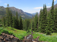
View up Hyalite Canyon
Today the plan was to hike the Hyalite Canyon Trail.  It is located all the way at the end of the Canyon where we happen to be camping.  Last year TH ‘discovered’ this place and we did a very small portion of the hike.  We also hiked out to the first waterfall called the Grotto over our winter trip to Bozeman numerous times in the snow. 

We had recovered from our last hike out to Emerald Lake so we decided we’d shoot for Hyalite Lake…5 ½ miles out and back.  ELEVEN freaking miles?  We must be nuts, but the elevation climb ‘wasn’t as bad’ as Emerald…or so we thought. 


Grotto Falls
Since we’d seen the Grotto Falls last summer we decided to bypass it…except we ended up going to it anyway.  The trail headed down towards the creek and before we realized it we were at the Grotto.  Coop made new friends playing with two Aussies…he even won the battle of the stick a couple of times.  Poor thing still has no clue what to do with it once he gets it. 

We had to climb back up to the trail to continue on our way…remember one of us HATES uphill climbs. 


Cooper, Honey & a stick


In comparison to the Emerald hike this trail was quite a bit more interesting…much more lush, wildflowers everywhere and actually followed along Hyalite Creek (or is it river?).  The trail went up into a horseshoe shaped canyon which is surrounded by steep cliff walls.  At the top are two peaks...Hyalite and Findley.

Along the way were a number of water falls (11)…some right alongside and others you had to hike a side trail.  We chose to bypass the side trails.  As it turned out that was a good idea...did we mention that it was an eleven mile hike without the side trails?   


Arch Falls
The next falls that we came upon was named Arch Fall.  An actual arch over the creek which was difficult to photograph well without falling off the cliff.  It was about this time that Cooper decided to run off with the big black lab running down the trail with his owners...who were running downhill too.  He lost his off leash privileges…although he was hightailing it back up the trail when he thought he’d ‘lost us’.   

Hightailing it back
We kept heading up in elevation (an increase of 2000 feet by the time we reached the lake) and the views back out over the canyon were impressive the higher we climbed.  All the waterfalls still had a good bit of water flowing…lots of Spring/Summer rains along with the snow melt have been good for the area. 

Apex Falls
The most impressive one was called Apex…a series of drops down the mountainside and two log bridge crossings of the fall gave us great views.  Chasm and Shower Falls were striking as well…lots of flowers along both creek banks. 
We finally arrived at Hyalite Lake…what a hike.  This time we were able to stop and catch our breath for a few minutes.  The flies left us alone once we sprayed ourselves down with OFF…not thrilling, but it beat the pestering nuisances biting us. 


Close up of top of Apex


Chasm Falls
Hyalite Peak

Log bridge


Section of S'il vous plait falls


View back down the Canyon

Rufous Hummingbirds


Male Rufous Hummingbird


Almost at the lake...looking down the canyon


Hyalite Lake

Break time...few flies

Clark's Nutcracker


Chasm Falls

Shower Falls


Return by log bridge
The trip up took us a bit over 4 hours…the trip down was about 3 hours.  A very long day and our feet didn’t want to discuss it.  Cooper’s feet didn’t either, but he did enjoy licking his.  The shower felt wonderful…the best camping purchase to date.  Tomorrow is a driving day…need to stop doing these 11 milers.  Our limit may just be 8 miles.